


Technical Abstract
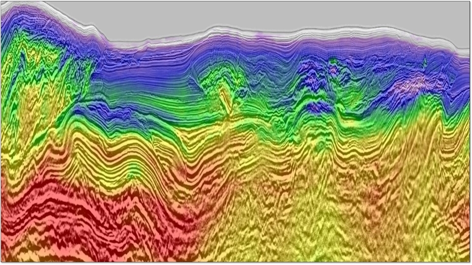
Imaging the complex geology in the Central Basin Platform with Land FWI
Back to Technical ContentRecently, land full-waveform inversion (FWI) has shown great potential in resolving near-surface complexity in the Delaware Basin, providing significant imaging uplift and useful information for shallow hazard identification. However, deep section updates beyond diving wave penetration remain challenging. We present an application of land FWI in the Central Basin Platform (CBP) for both shallow and deep updates. Results show that, with a time-lag cost function, a fine spatially sampled data set with proper preconditioning, and a good starting model for regions beyond diving wave penetration, land FWI was able to produce a high-resolution velocity model to resolve small-scale anomalies in the deep sections as well as detailed velocities in the near surface, leading to improved seismic images at reservoir levels. Furthermore, the impact of the FWI input data spatial sampling and the starting model in inversion are studied respectively.
Download Resource 
Publications
SEG - Society of Exploration GeophysicistsAuthors
Dongren (Alan) Bai, Lin Zheng, Wubing Deng