


Technical Abstract
Exploring the full potential of a sparse nodes survey in the Western Gulf of Mexico
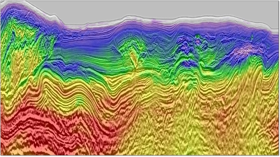
Back to Technical ContentThe western part of the Gulf of Mexico (WGOM) is often characterized by large and complex salt and shale bodies, making it notoriously challenging to image deep subsalt targets, especially with only wide-azimuth towed-streamer (WATS) data available. In 2018, BHP acquired a large-scale sparse ocean bottom node (OBN) survey in this region with the intention to derive a more accurate velocity through full-waveform inversion (FWI) for WATS data imaging. The relatively large shot spacing in this survey, compounded by the complex overburden and the strong reliance on long-offset data (>40 km) for deeper model updates, pose considerable challenges to the processing of this sparse nodes survey. We present how we mitigated the noise issue accompanying this sparse nodes survey and made better use of the long-offset data to unlock the full potential of this data set, ultimately obtaining improved velocity model and images in this complex area. We also demonstrate possible ways to further improve the sparse nodes data, such as by using a better low-frequency source.
Download Resource 
Publications
SEG - Society of Exploration GeophysicistsAuthors
Feng Lin, Dorothy Ren, Jiawei Mei, Zhiguang Xue (CGG) ; Joakim Blanch (BHP)